Our plan to visit New Mexico came about in an odd fashion: The idea was to get the cheapest airfare out of of Sacramento to someplace warm—Phoenix, AZ, we devised—and just find a large resort with a good pool to relax, and maybe do some day trips. Next thing I knew, I was drawing up sample maps between places as distant as White Sands, New Mexico, and the Grand Canyon. Wanderlust got the best of us yet again.
As it turned out, most of the places we were most excited to visit were in New Mexico and so, it soon became evident, we should simply concentrate our efforts there. We rearranged our plans to fly into El Paso, Texas, from where we would rent a car and drive north into the “Land of Enchantment”—from Carlsbad Caverns and White Sands in the south, up to Albuquerque and Santa Fe in the north. Alas, the tickets weren’t cheap, and most of our stops in New Mexico were not warm (it even snowed in Santa Fe!)—it was not at all the Spring Break we’d been in search of—but in the end it was all a wonderful surprise. It was, indeed, enchanting.
Planning the trip presented some challenges. As I mentioned, it turns out that New Mexico can be quite cold in March. Silly Californians, we underestimated the sheer size of the state and under-appreciated its range in altitude, and we were surprised when we discovered how many of the activities we’d been excited to check out (exploring Taos Pueblo, horseback riding, river rafting, scenic railways, etc.) had winter closures or wouldn’t be offered until late spring. So if you’re planning a trip yourself, it does seem that the ideal time may be a few weeks after we arrived—before the summer crowds or the extreme heat in the south, but late enough that the snow has melted in the mountains.
At the same time, there was still more than enough to see and do without these stops, and most of it was hours apart by car. As it turned out, a week was just barely enough!
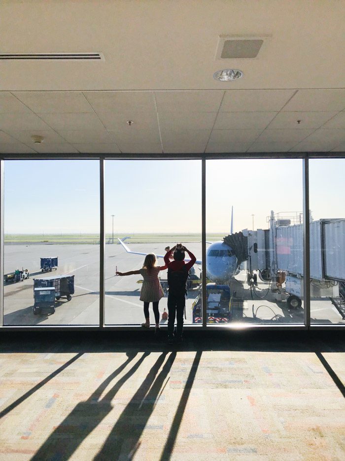
We flew to Texas via Los Angeles—with a long enough layover to seek out the play area and the better restaurants in the International Terminal. If you’re ever stuck in LAX, be sure to make your way to the Bradley terminal right away.
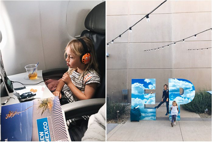

We got into El Paso in the late afternoon—the dry, warm air a welcome treat—picked up our rental car and headed straight for L & J Cafe, where we’d learned “the Old Place by the Graveyard” served the best “border flavor” enchiladas. We tried the green and the red chile and, even days later, couldn’t stop talking about the latter. When we pulled up, Patsy Cline was audible in the parking lot, and people were waiting for tables outside. I placed a to-go order at the host stand so we could start our drive to Carlsbad as soon as possible.
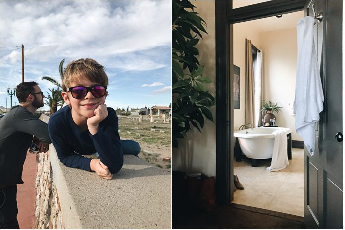
It’s about 2-1/2 hours from El Paso to Carlsbad. Most of the hotels catering to visitors of the Carlsbad Caverns are lined up along the highway, but I’d read about one more unique hotel—The Trinity Hotel—that’s set downtown in an 1892-bank building, and chose it for our first night. It was nicer than we needed, but we really appreciated landing in such a nice room (201, with a giant clawfoot tub!) after a long day of travel and on the first night of our trip. The hotel has a wine bar and restaurant, too—so I knew we could have both a nightcap and a hearty breakfast before setting out for the day.
A lot of people have asked about how we go about sharing rooms with our kids and, recently, we’ve found great success with a king/sofa-bed set-up. The kids are excited about pulling out the bed and, once they’re asleep, we find we can turn on some lights or even the television and move around without their noticing. All the better if the room has a balcony or a large bathroom—or a downstairs bar—for at least one of us to sneak off to while they do fall asleep, as the hardest part is not getting drowsy oneself in a dark room at 8pm.
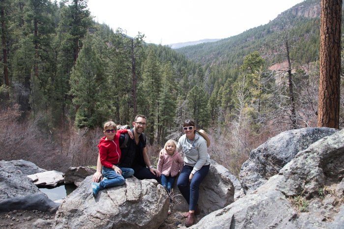
Note the two kitty stuffies—named Golden and Solly—acquired at the airport when we realized that we’d forgotten to pack theirs. Soon after, we realized we’d also forgotten our backpack carrier—dearly missed on many of the trip’s hikes—but we couldn’t replace that as easily.
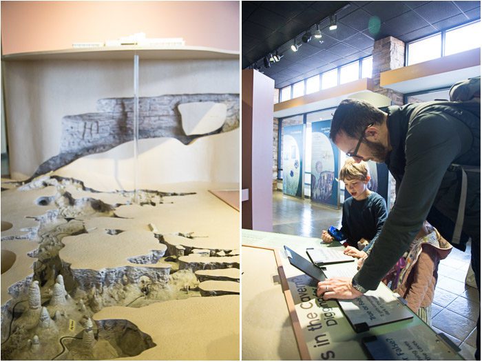
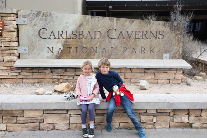
Carlsbad Caverns National Park features over 120 caves—and counting!—that are hidden beneath the Guadalupe Mountains of southeastern New Mexico. Formed when sulfuric acid dissolved limestone leaving behind caverns of all sizes, the most famous of the caves—the largest accessible chamber in North America, at 8.2 acres—is called the Big Room or The Hall of the Giants.
Though the area was populated 12,000 years ago by Native Americans, they were first introduced to the public at large when Guano (bat dung) mining started taking place in 1903.
Now the caves see thousands of visitors every year. The majority come in the summer when the 400,000-plus population of Mexican free-tailed bats that roost inside the cavern are also most active, and the nightly bat-flight program is running (May-October).
You can visit the Big Room in the caverns on self-guided tours, but many of the caves can only be seen with a ranger. Because of age-restrictions, only one ranger-led tour was an option for us—King’s Palace.
I made reservations for the first tour of the day a few months before our trip, thinking we’d start with that and then hike down the Natural Entrance route into the Big Room in the afternoon. But I only made one teensy mistake…
For some reason, despite having put all the details about the reservations onto a Google Doc, and despite the option to confirm things online when we were at the hotel, I just checked the guidebook we’d brought for tour times in the morning and based our departure on that. We ate breakfast and started to head for the park as if our tour started at one time, when in fact it started at another. Plus, you need to arrive 30 minutes before your tour time. When I ran to the ranger’s desk, she told me we were too late to meet the group and would have to join an afternoon tour instead.
So we reversed our plans, beginning with the natural entrance hike down into the Big Room. I figured we could see how we felt afterward, and decide whether to use our pre-paid tickets. We also opted, at this point, to buy the America the Beautiful National Parks pass and I think we recouped the value on this trip alone.
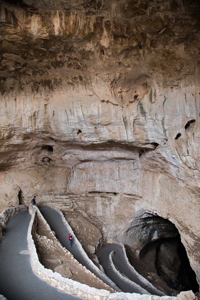
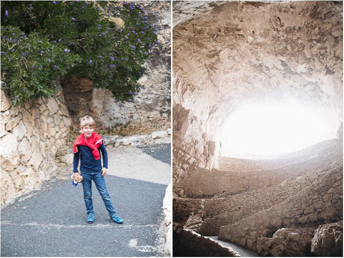
The Big Room, the most popular route, is the largest single-cave chamber by volume in North America. The 1.25-mile trail is relatively flat, once you’re inside, but there’s also the option to hike down the steeper Natural Entrance (an additional 1.25 miles), where one loses (or gains) about 750 feet. We opted to do this and were so glad we did—it really gave us a better sense of our position underground and helped us appreciate just how deep the caves went. In fact, this may have been my favorite part.
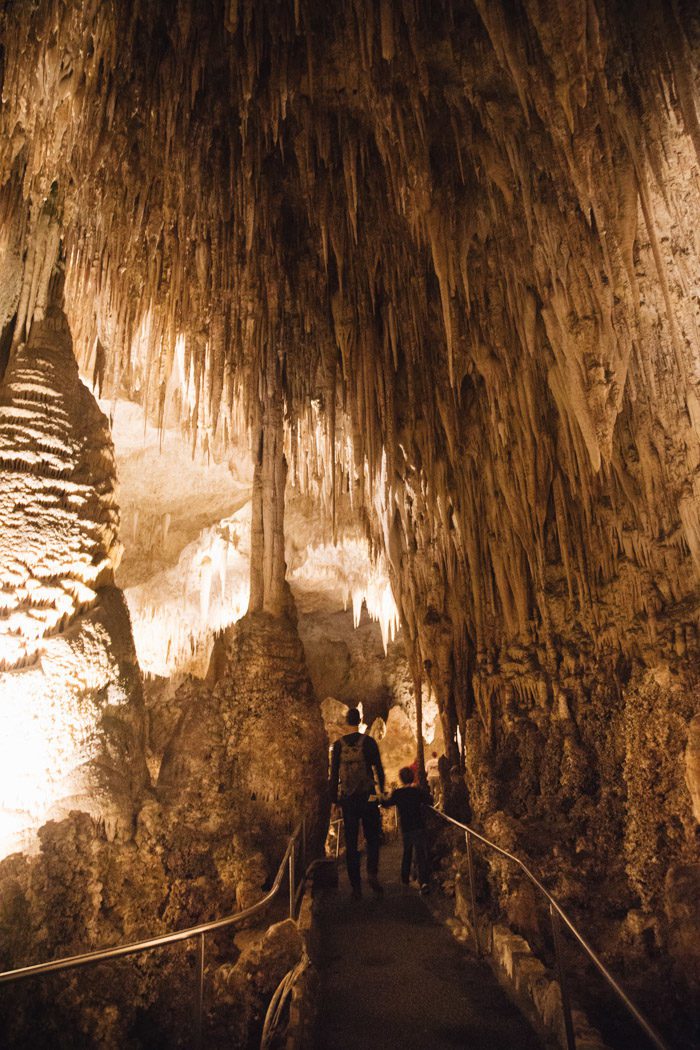
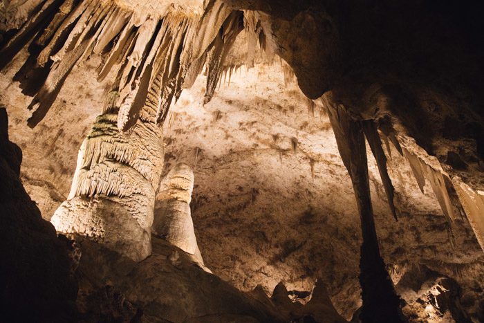
Once you’re inside the cave, there are lights illuminating the various stalagtites and stalagmites—otherwise it would be pitch black!—though a ranger showed us that a flashlight can reveal additional detail in the walls, so bring one if you can. There are columns, “soda straws, draperies, helictites, and popcorn”—various formations of speleotherms for the budding explorer or cave enthusiast to get excited about.
Hudson thought the giant stalagmites looked like monsters and still refers to them as such.
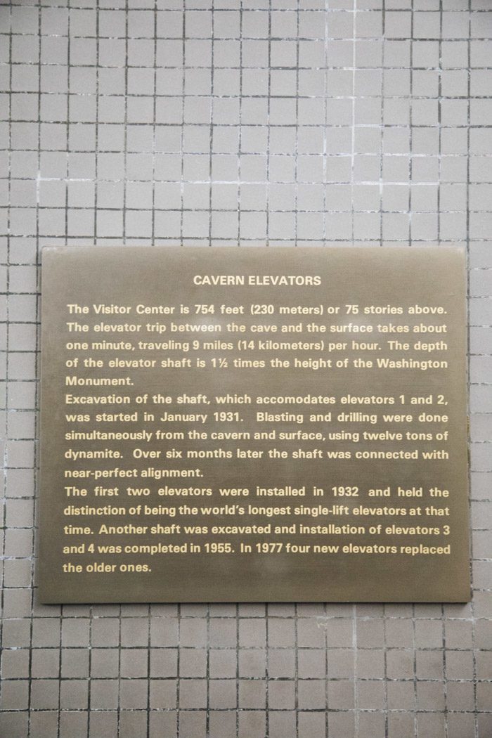
There’s one snack bar in the Big Room cavern (and bathrooms)—otherwise you’re asked not to bring any food—and there are elevators that ferry people from top to bottom. When it was time to go, we opted to ride the elevator up rather than hike out, and the wait was long—even though it wasn’t very crowded. I can’t even imagine it in the peak summer months!
Later I learned that just a few days after our visit, one of the elevators became stranded at 740 feet below the surface with three visitors inside! They were rescued in a few hours, but until the cable is repaired, there is no elevator service into and out of the cavern—though one can still use the Natural Entrance Trail.
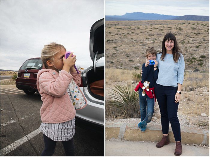
We ended up deciding that, as cool as the second tour into King’s Palace might be, we were ready to stay at surface level and make our way over the mountains toward White Sands National Monument. Two tours would be a lot for the kids—especially since you’re supposed to talk at a whisper when you’re inside. They got to pick out some geodes from the gift shop, and we went on our way.
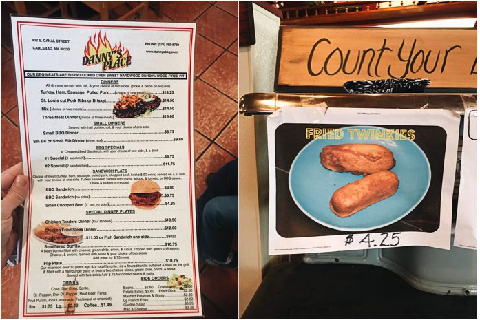
A quick search told us that Danny’s Place was the spot for local barbecue. We again opted for takeout—including our first fried Twinkies—and hit the road.
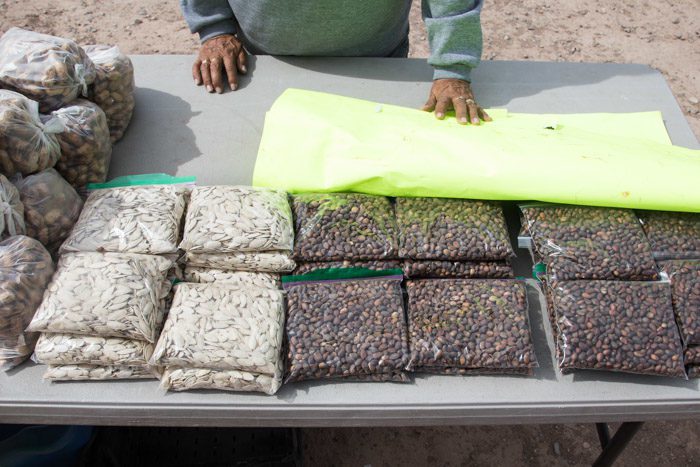
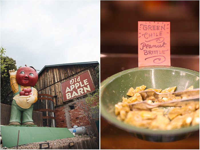
A few nutty highlights along the way: We stopped at a roadside nut stand to buy piñons (pine nuts) that came with the shells still on. We snacked on them without hulling them, but in hindsight I’m not sure my dentist would approve of taking the risk.
And we took a break at the Old Apple Barn off Highway 82 in Mountain Park for some pine nut coffee, as well.
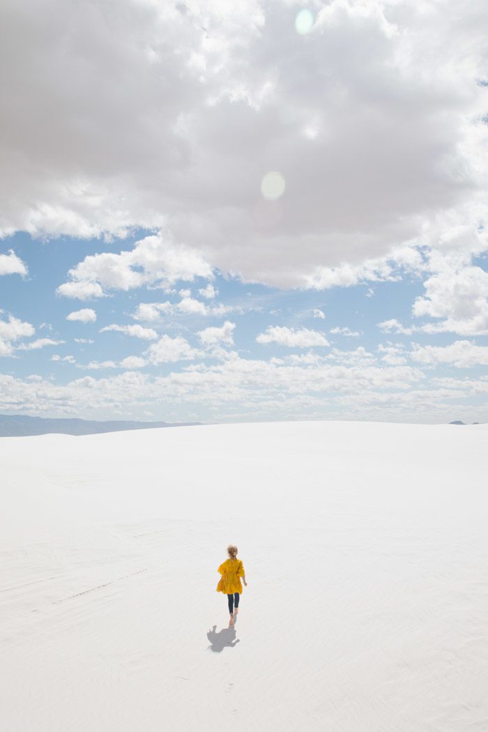
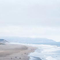
The route took us through the mountains—via Cloudcroft, at nearly 9,000 feet in elevation—about three hours west to Alamogordo and White Sands National Park. In the photo above, you can just make out the stripe of white gypsum where White Sands is.

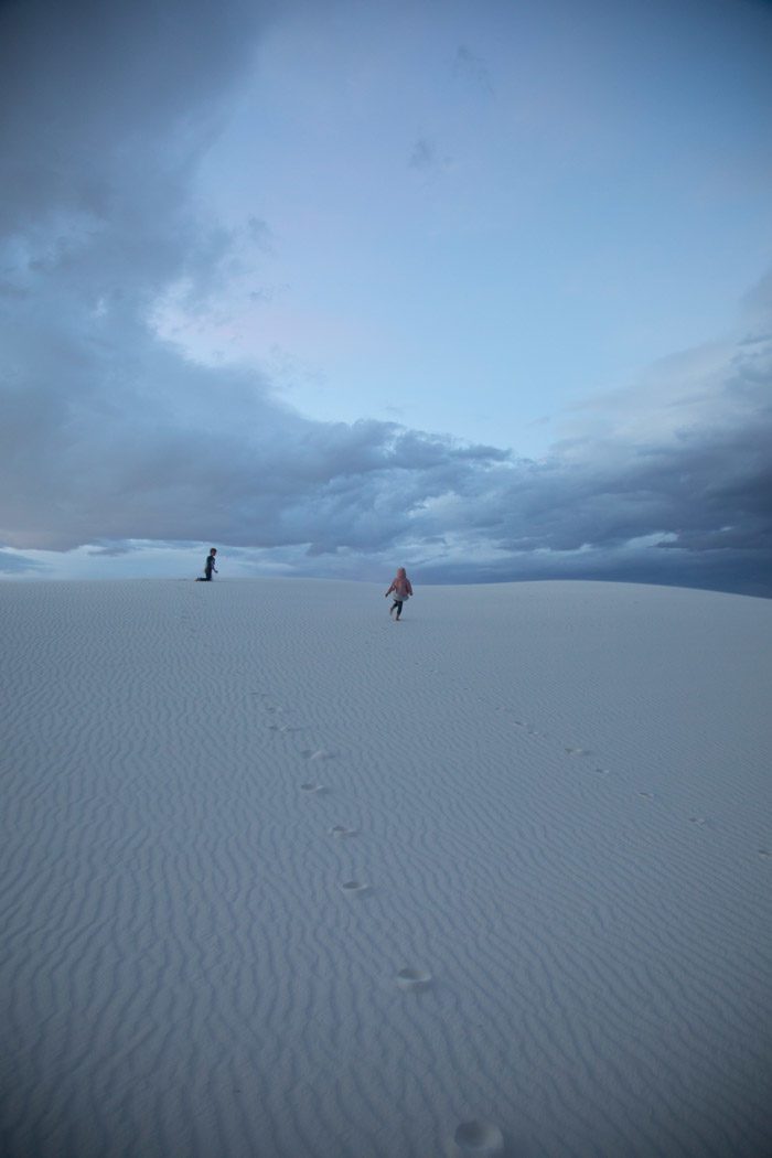
At the northern end of the Chihuahua Desert lies a mountain-ringed valley known as the Tularosa Basin which has, at its heart, 300 square miles of white gypsum sand dunes.
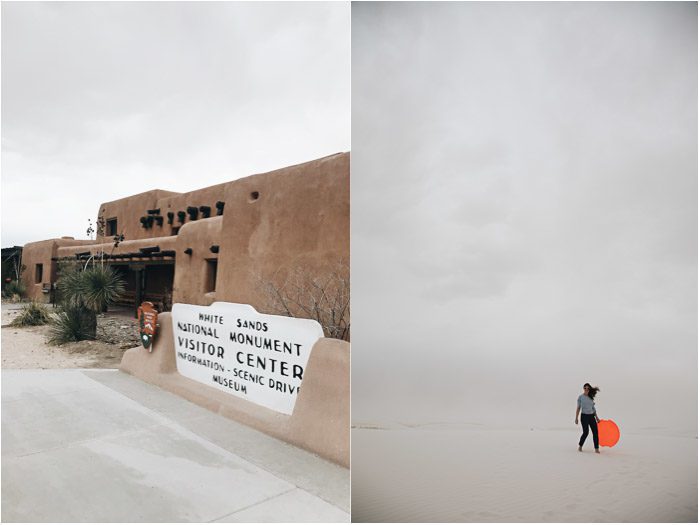
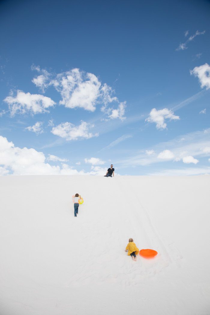
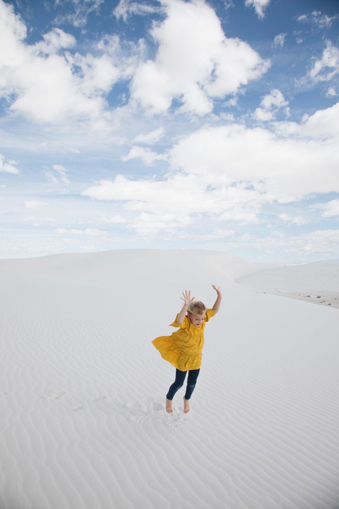
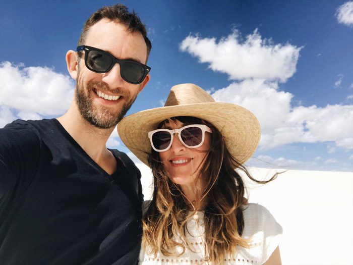
I wrote all about our visit in a dedicated post, so I won’t repeat too much here—except to say that the dynamic landscape was incredible! From the windstorm that greeted us upon our arrival to bright sun and blinding-white dunes that capped off our visit, I felt like we experienced such a wide range of beautiful conditions in such a brief time.
Indeed, when we arrived, we couldn’t believe our eyes: wind and rain—at a place where it’s sunny 330 days out of the year! But it didn’t stay that way for our whole visit…
We drove in and out of the park a few times on our first night, grabbing (very good) frozen custard and chili hot dogs in between at Caliche’s, and spending the night at the Alamagordo Marriott—which had an indoor pool and a nice breakfast buffet for us to enjoy, too.
The next day, everyone was prepared for sandstorms in the morning with swim goggles, but we arrived to clear skies!

When we’d finished playing, we went back to the hotel to shake out our clothes, have a quick swim and shower, before heading north toward Albuquerque.
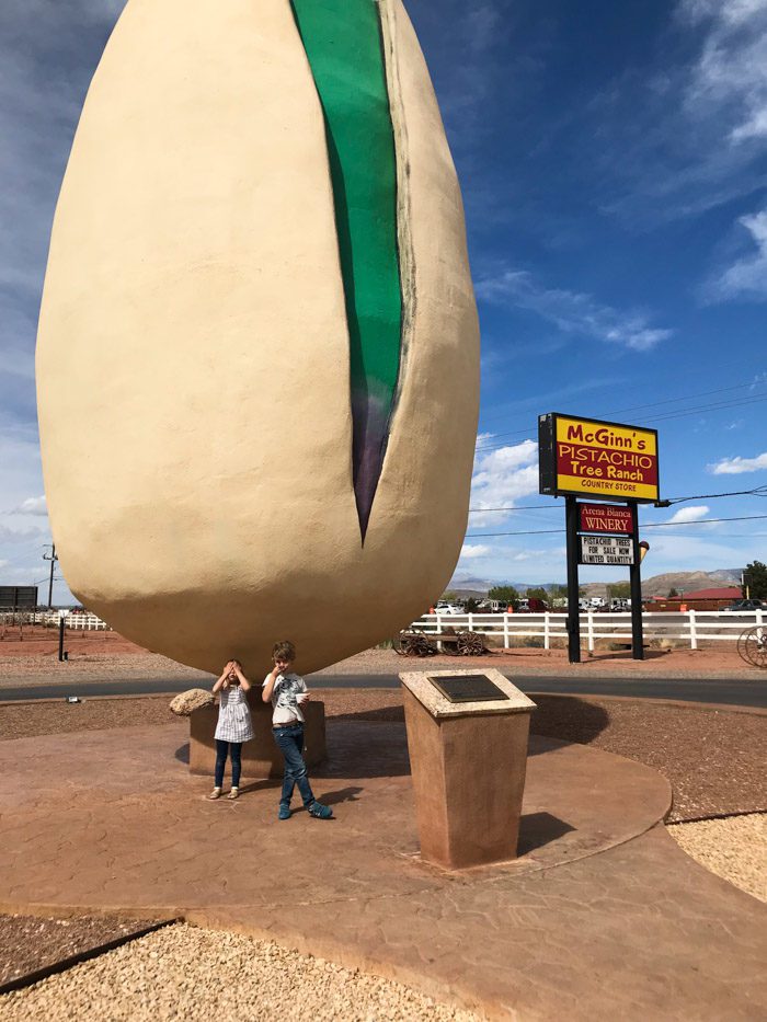
On our way, we passed a few of the other top attractions in the area: the Alameda Park & Zoo, the oldest in the Southwest; the New Mexico Museum of Space History, which we could pick out on the hillside by the sight of a giant rocket; the Toy Train Depot, identifiable by a small-scale train that circles Alameda Park, with hundreds of model train and toy trains on display inside; and PistachioLand, with the world’s largest pistachio outside.
We stopped at the last point of interest and took the obligatory photo in front of the giant nut, picking out some snacks for the road, but I was a little disappointed to find that they don’t make their own pistachio ice cream on site.
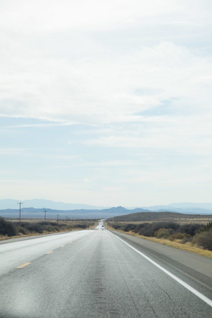
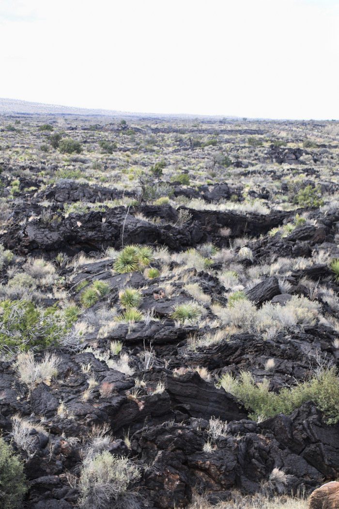
We joked that you really have to appreciate rocks to appreciate this trip: a lot of the beauty came from seeing the way the landscape would change colors along the way. Only 14 miles from the white gypsum, we came to the Valley of Fires, where a large lava flow, the Carrizozo Malpais, can be found on the northern part of the Tularosa Basin.
We just stopped at a lookout point, but there are trails that lead you through the relatively young, and extensive lava flow; it’s four to six miles wide, 160 feet thick, and covers 125 square miles!
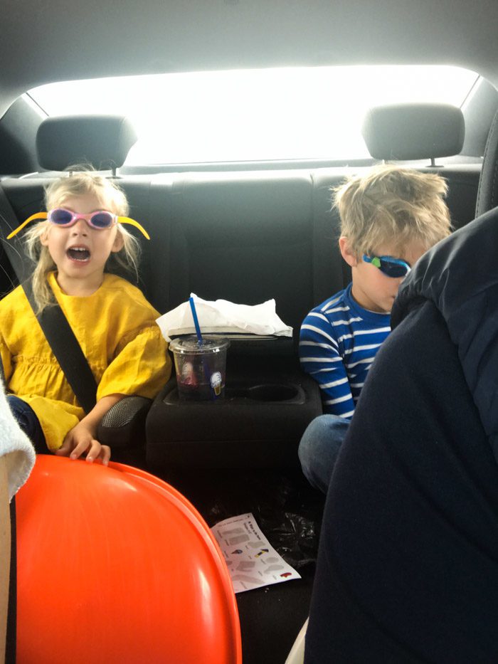
The long car rides with the kids went well. We listened to Hudson’s favorite podcast, Circle Round, and some audio books; the kids got to play on our phones or watch a show from time to time; and Hudson played with his perplexus ball while Skyler colored a gazillion stickers. You never know for sure which last-minute coloring book or activity pack will be the winner, and this time it was a Melissa & Doug magic color sticker set that occupied Skyler for hours.
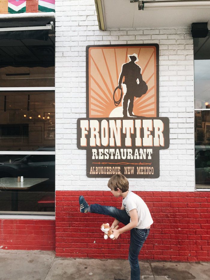
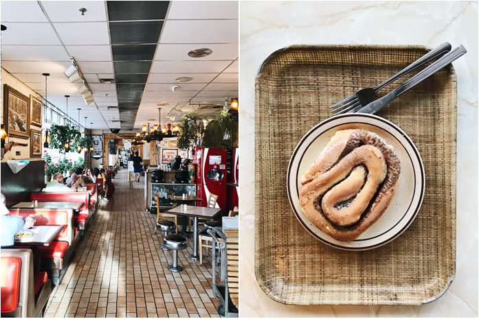
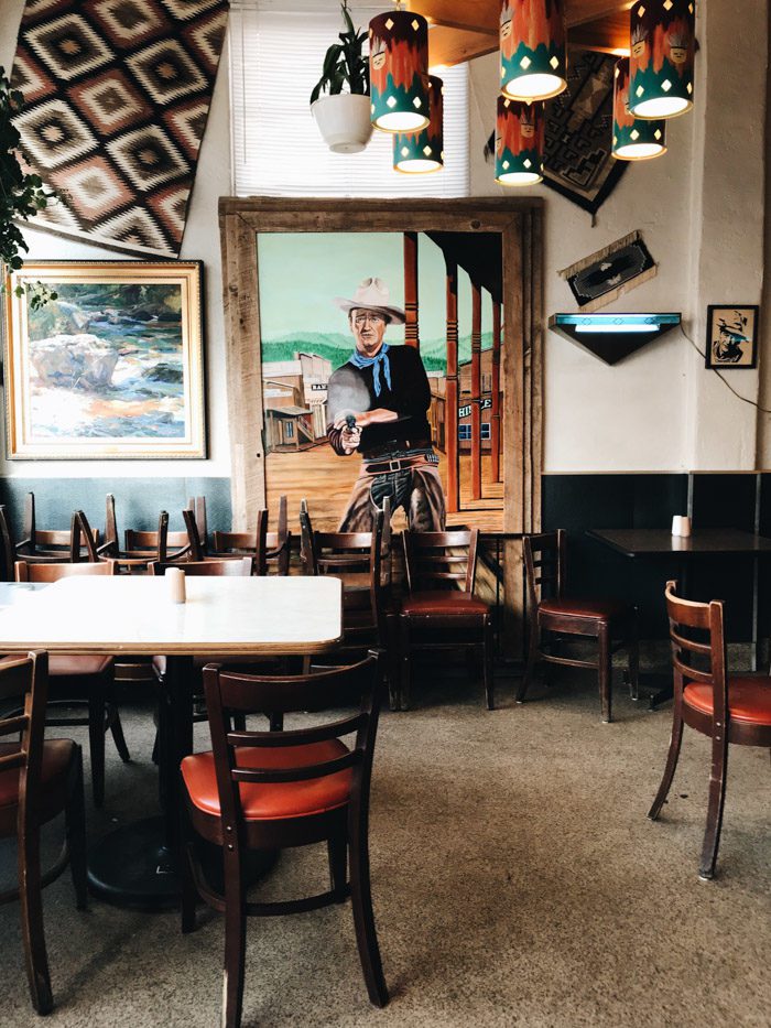
When we got to Albuquerque, we knew dinner should be our first priority: a few readers had recommended we check out the Frontier Restaurant across from the University campus, and it suited us well. You order from the counter and then choose a seat where you like—under one of the many images of “the Duke.”
And, when you’re done, you can go back and get a hot Sweet Roll from the counter. We ended up coming back and getting another one to go before we flew out at the end of our trip.
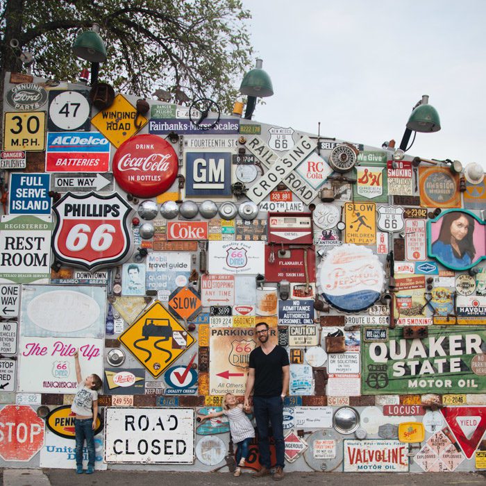
Back in 1926, when Route 66 was first commissioned, the route ran north-south through Albuquerque—506 miles of mostly unpaved road—and the town still holds many of the hallmarks of the famous roadway. Cars was definitely a handy reference for making this more interesting to the kids, though I did my best to sing the Nat King Cole song.
We spent the last few hours of daylight checking out neon signs and old motels that still sit close to downtown, and then checked into our hotel, Albuquerque Marriott Pyramid North, to the Northeast of town, in the shadow of the Sandia Mountains. When we got there, I remembered that we actually chose the location with the idea that we’d skirt town and not pass through downtown Albuquerque until the end of our week—but I’d forgotten all about that! Luckily there wasn’t really any congestion and it didn’t matter much.
In other words, we just happened to stop in Albuquerque because it made the most sense for the next leg of our road trip: we’d follow the Jemez Mountains scenic byway, stopping for a short hike to some hot springs, before visiting Bandelier National Monument, and landing in Santa Fe for the next four nights.
In the morning, we looked out to find hot air balloons dotting the sky, and followed them north toward the Jemez Mountains.
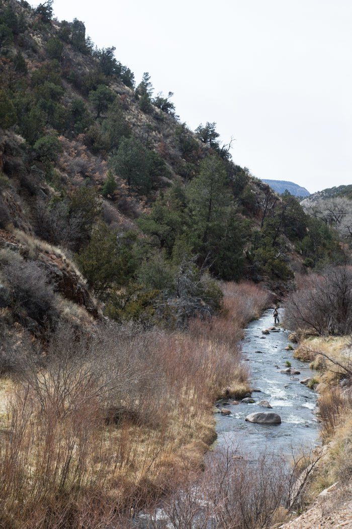
The town of Jemez Springs is home to a few spas that might be interesting for adults, but we weren’t sure they’d be the right places to stop with the kids. Instead, we drove just beyond town to Spence Hot Springs, between mile markers 24 and 25. There’s a small loop parking lot with a trailhead. The springs are a short hike up the hill.
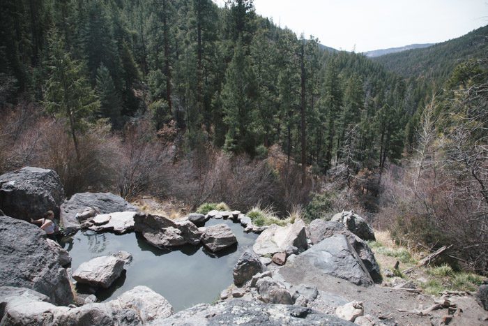
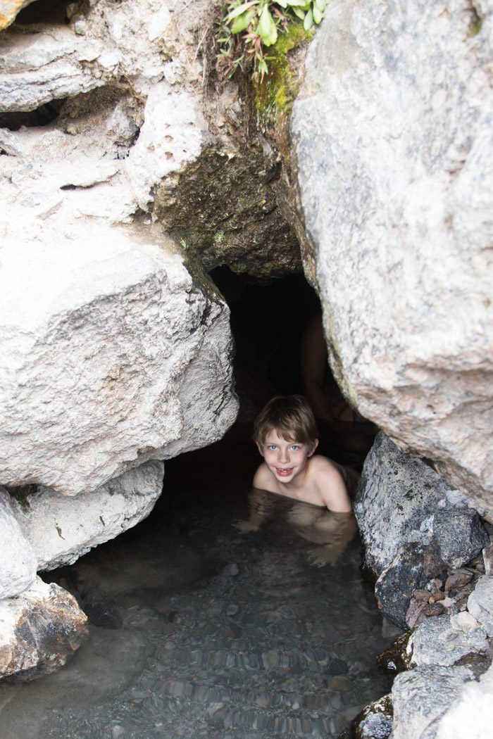
The spring itself is inside a cave, and the water inside the cave seemed clean and clear, and the perfect temperature. But the pools outside were a bit more lukewarm—and clearly popular—so we didn’t linger for too long. Skyler was in and out before I could fold up her pants! So I got out pretty quickly to warm up and keep an eye on her. Of course, as soon as she was fully dressed, she was upset that her brother had gone in a cave without her; but we weren’t willing to go through the dressing/undressing ordeal in the cool mountain air again.
Some wisdom we’d wished we’d had: If you head up that way, climb to the top of the pools to change and set down your things in the large clearing. The path itself is pretty narrow and it’s a bit of an awkward spot for a deck-change.
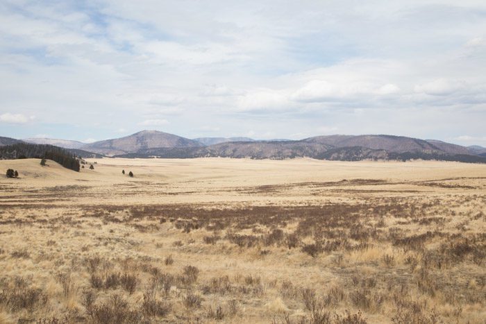
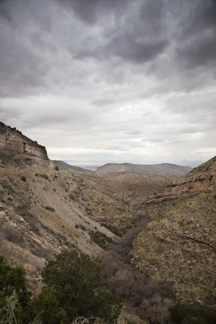
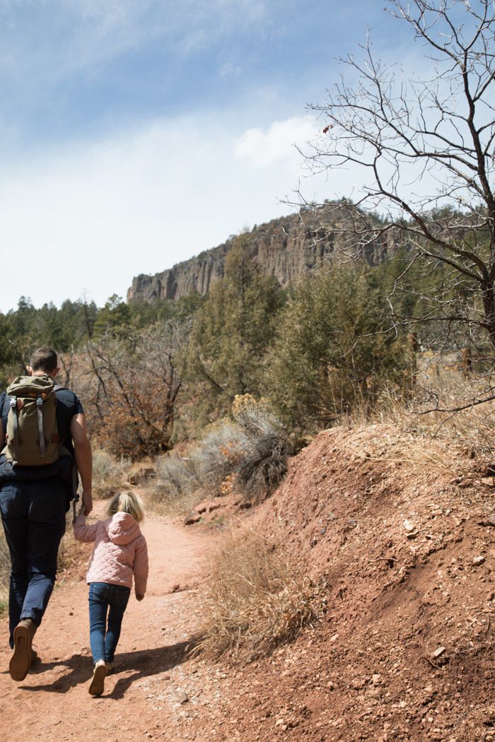
163 miles long, the scenic byway takes one past Jemez State Monument—with the extraordinarily red rocks of Jemez Pueblo—Soda Dam, Cabezon, and Battleship Rock, before continuing through Valles Caldera National Preserve, a beautiful expanse of mountain meadow and forest, where we craned our necks in hopes of spotting the herds of elk who call it home, and onto Bandelier National Monument.
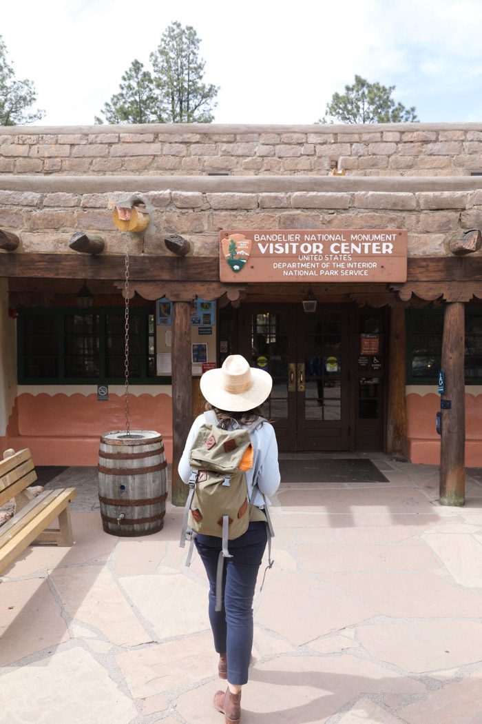
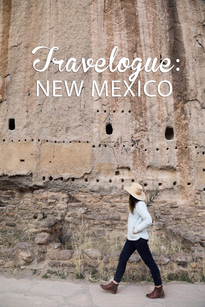
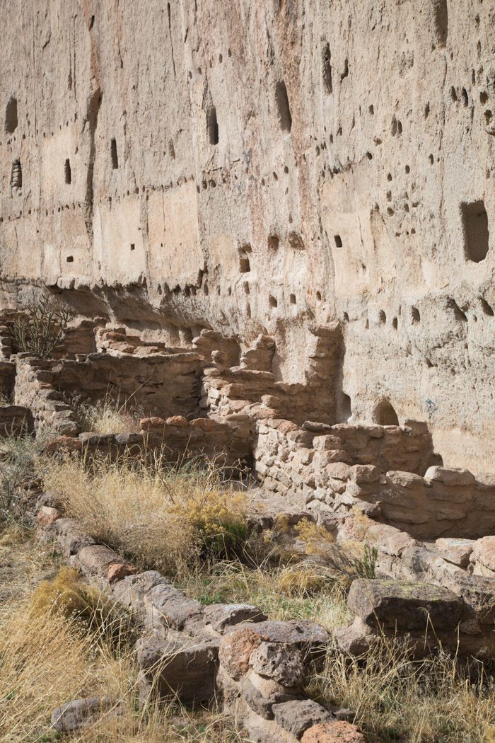
We pulled into Bandelier National Monument in the early afternoon and immediately were in awe of the steep-walled canyons and mesas that surrounded us. The monument, over 33,000 acres in total, houses several thousand ancestral Pueblo dwellings within those canyons, and it’s an awesome opportunity to connect with history.
The visitor center had some useful tips about the trails and loaned us a copy of the trail tour book, so we could stop and read at markers along the way. Apparently the site gets very crowded in the summer and guests have to take a shuttle in from a remote location, but we had the place practically to ourselves—one perk of the off-season, but also of the the later hour in the day.
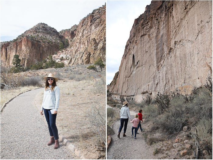
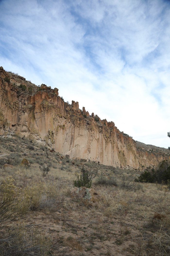
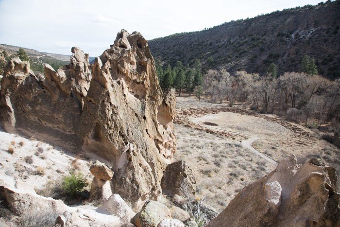
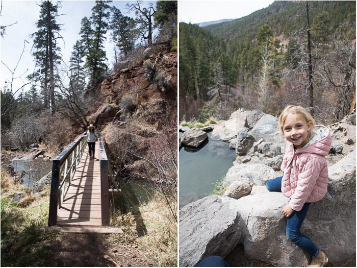
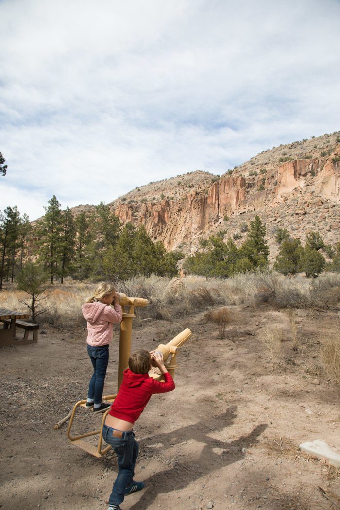
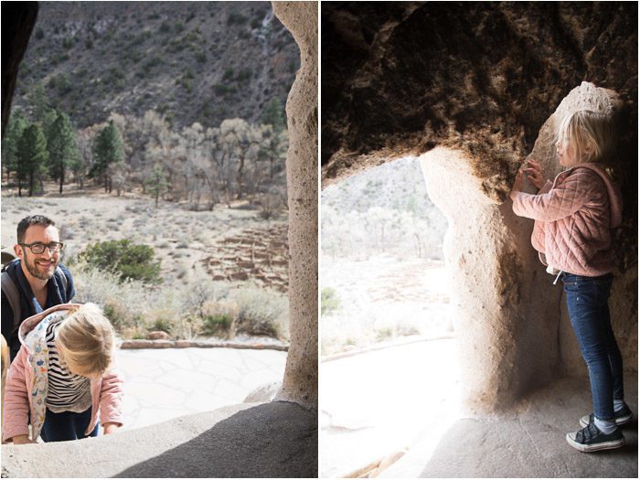
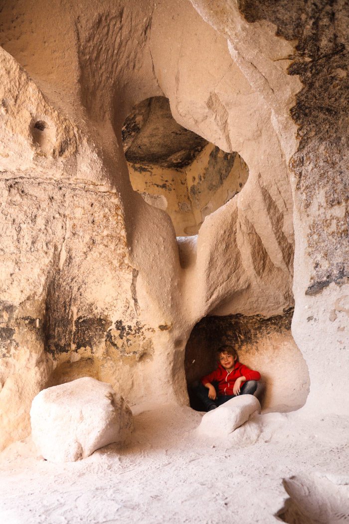
There are over 70 miles of trails within the park, but the most popular route is the Main Loop Trail—a 1.2 mile loop through archeological sites, where visitors can climb into cavates (small human-carved alcoves).
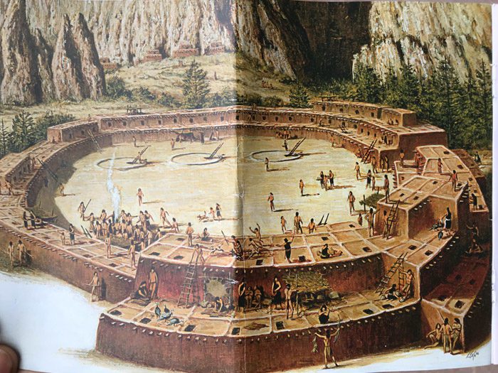
The tour book had some drawings that helped one imagine how the homes and public spaces might have looked when occupied by the ancient Puebloans, and helped us identify petroglyphs on the walls.
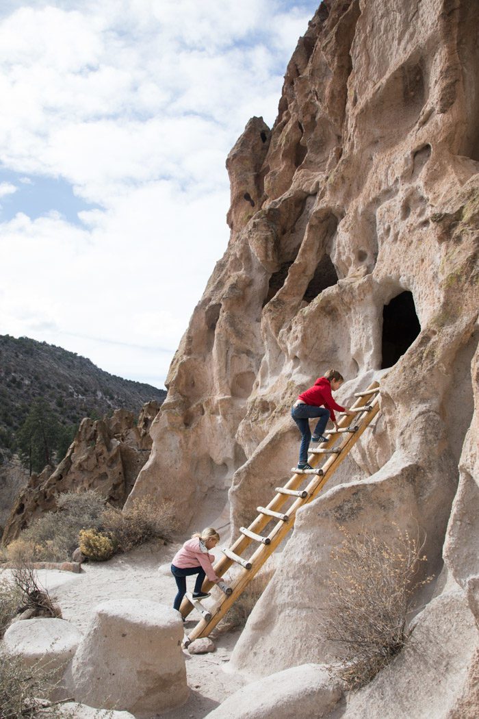
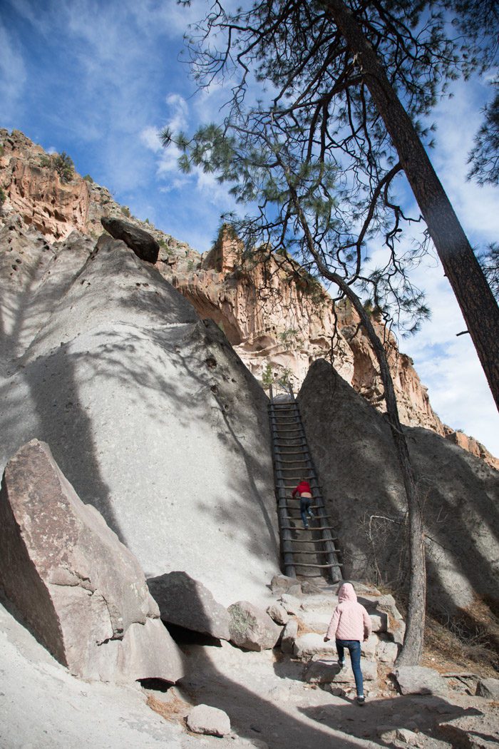
But the best part—especially for the kids—was getting to climb up the (incredibly well-designed and sturdy) ladders into the alcoves.
Half way through the Main Loop Trail, you can choose to continue another half mile each way (1 mile round trip) to Alcove House. 140 feet above the floor of Frijoles Canyon, and once home to approximately 25 Ancestral Pueblo people, the elevated site is reached by four wooden ladders and a number of stone stairs.
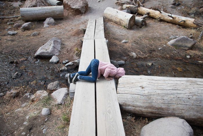
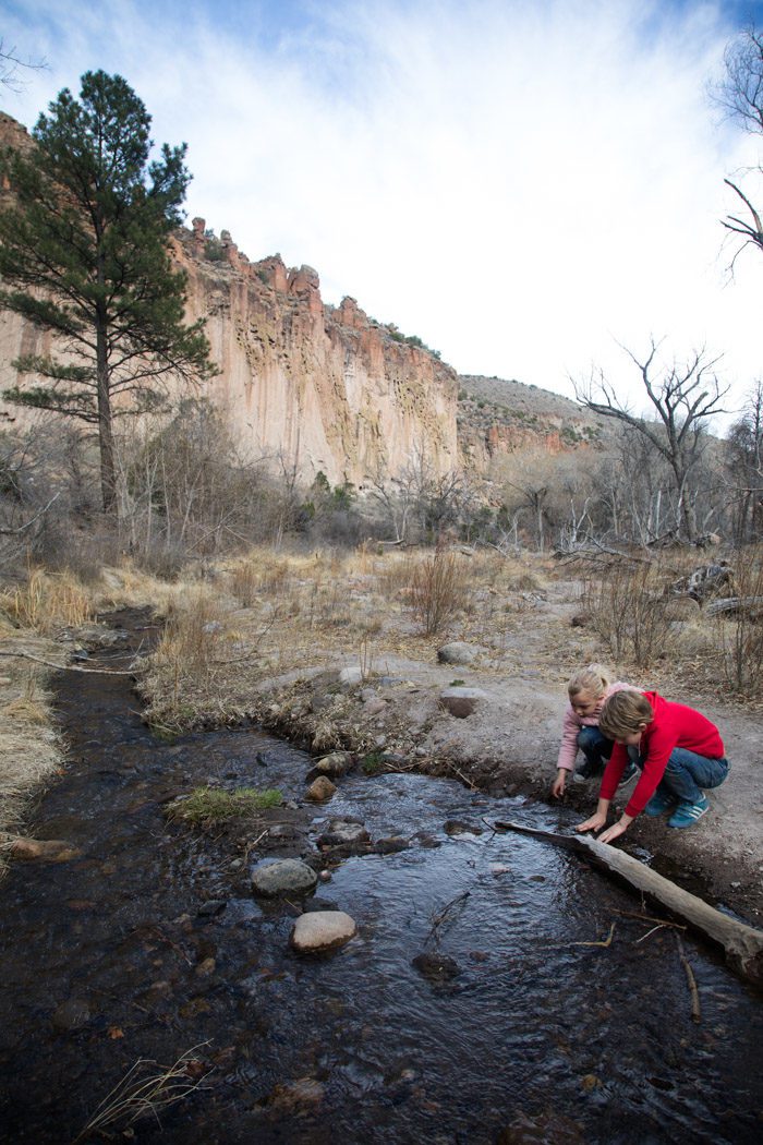
The kids loved the small stream crossings along the hike. Skyler checked under every bridge for trolls (à la the Billygoats Gruff).
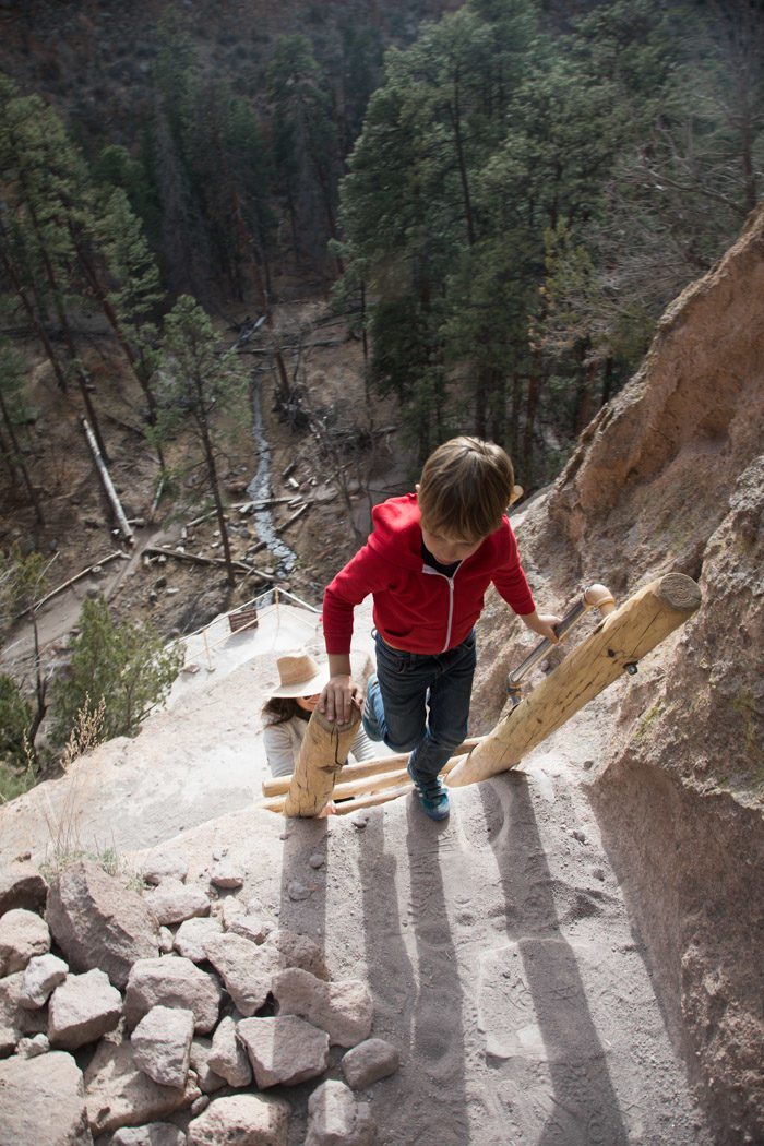
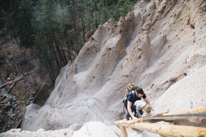
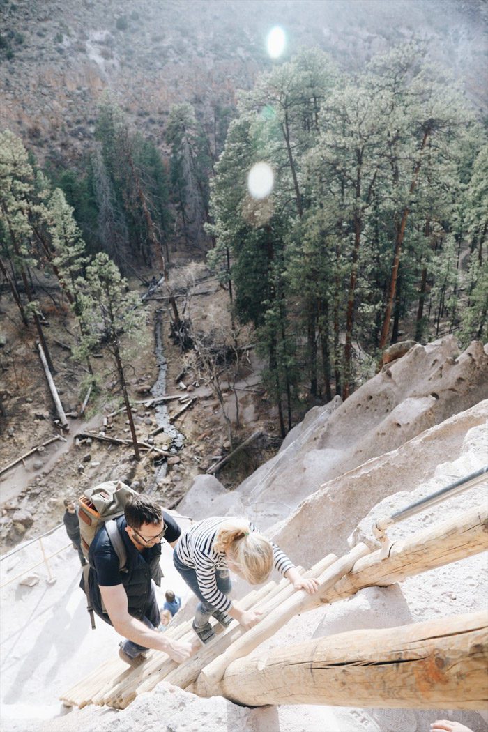
In hindsight, we can’t believe we went up those four ladders with the kids. It was definitely nerve-wracking. Skyler just didn’t have the appropriate degree of concern about holding onto the railings at all times and would resist when we tried to climb in a way that wrapped around her. It was a long ways up!
I don’t think you’d be missing out to stop short of the Alcove house—the Main Loop Trail is really incredible and gives you such a great sense of the canyon on its own—but we couldn’t resist checking out this site as well.
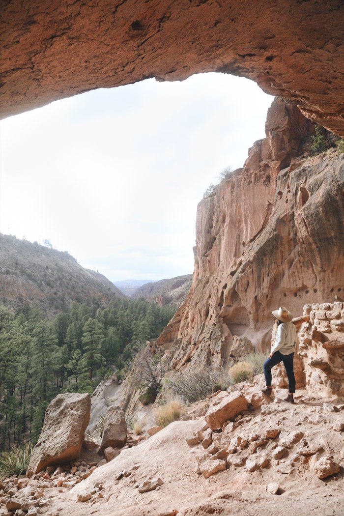
The views were incredible!
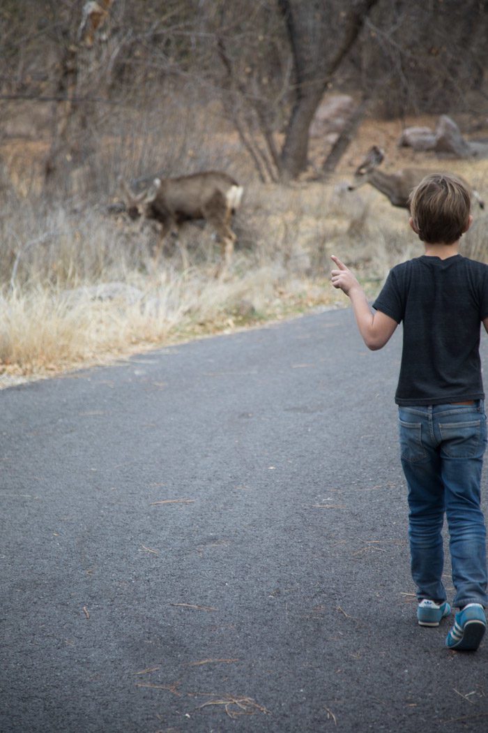
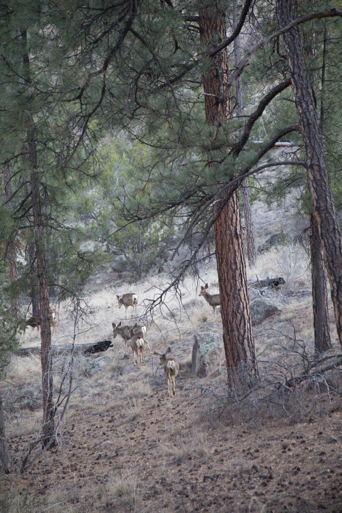
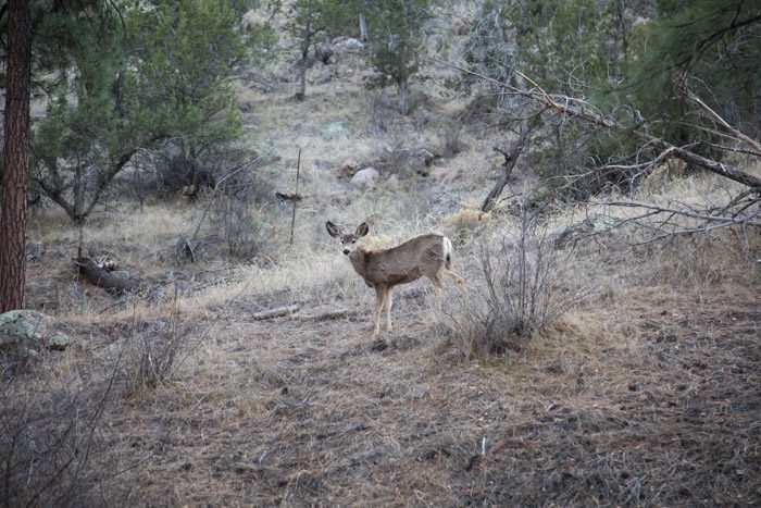
On the way back, we stopped to watch some deer and as one bounded across the road in front of us, Hudson exclaimed, “this is really amazing, isn’t it?” That definitely solidified that afternoon as a highlight of the trip!
Next stop, Santa Fe!
Have you been to Southern New Mexico? Any tips to add?
Previously: White Sands National Monument; Next up: Part two, with Santa Fe, Tent Rocks, and Ghost Ranch.
Also: Crowd-sourced recommendations for New Mexico.


16 Comments